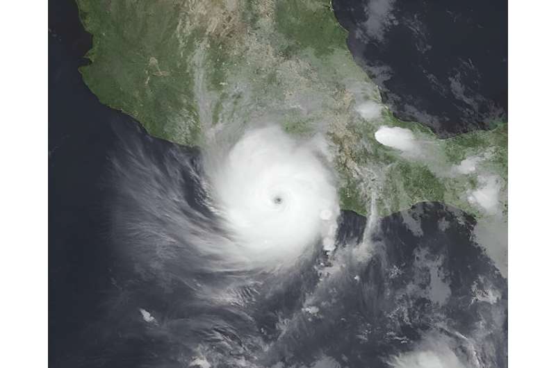
In the wake of the destructive Hurricane Otis, we find ourselves at a pivotal moment in the history of weather forecasting. The hurricane roared ashore with 165mph (266kph) winds and torrential rainfall, slamming into the coastal city of Acapulco, Mexico, and claiming the lives of at least 48 people.
The speed at which Otis intensified was unprecedented. Within 12 hours it went from a regular tropical storm to a “category 5” hurricane, the most powerful category and one which might occur only a few times worldwide each year.
This rare and alarming event, described by the US National Hurricane Center as a “nightmare scenario“, broke records for the fastest intensification rate over a 12-hour period in the eastern Pacific. Otis not only caught residents and authorities off guard but also exposed the limitations of our current predictive tools.